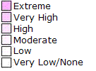
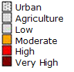
Open topic with table of contents
Hazard areas on the map are indicated by the following key. Areas will be outlined and color coded and shaded as appropriate.
For a description of each hazard see Hazard Risks.
| Risk: | Map Key: | 
| Earthquake | 
                         | 
| Flood Zone | 
                         | 
| Hail | 
                         | 
| Hurricane | 
                         | 
| Lava Flow HZONE | 
                         | 
| Tsunami Evacuation Zone | 
                         | 
| Wind Driven Water | 
                         | 
| Wind Driven Debris Wind speed MPH | 
                         | 
| Damaging Winds | 
                         | 
| Fire Station | 
                         | 
| Sinkhole | 
                         | 
| Sinkhole Risk | 
                         | 
| Wildland | 
                         | 
| Brushfire | 
                         | 
| Coast | 
                         | 
| Island | 
                         | 
| Territory | 
                         | 
             Help file last modified: 7/26/2018